RAGLD Property Info
As part of the RAGLD Project, we built a proof-of-concept Property Information Service, in collaboration with the Ordnance Survey and the University of Southampton.
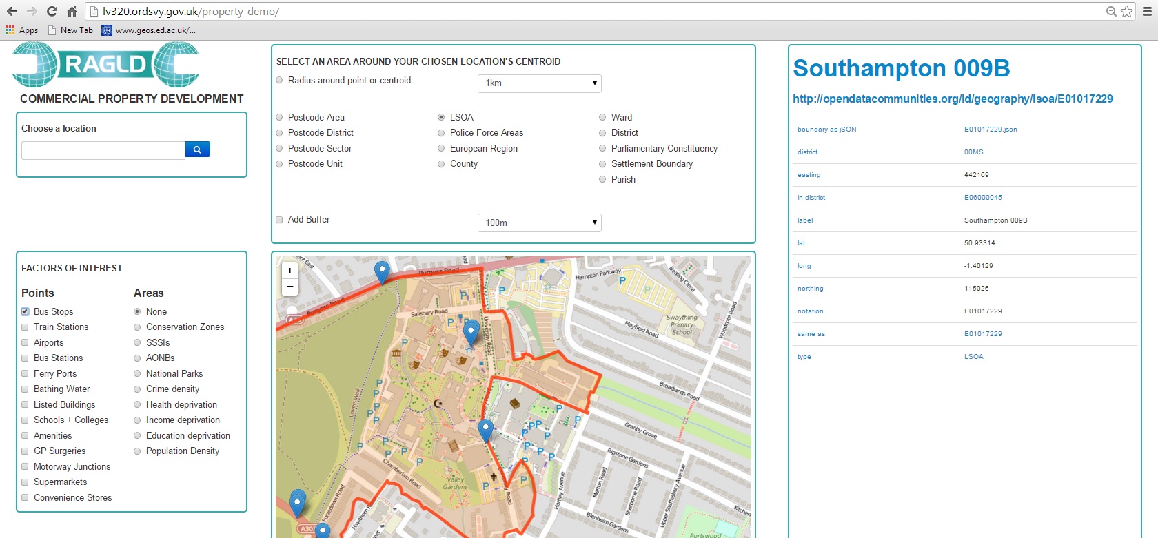
The web application:
- Brings together Linked Data and Geospatial data
- Given a place name or postcode, displays a range of information relating to that location
- Allows users to select various layers/points of interest and to determine the size/type of the region of interest surrounding the location
- Has a Linked Data viewer describes details relating to the chosen location/region