See UK
See UK provides a visualisation of Open Data about a variety of topics
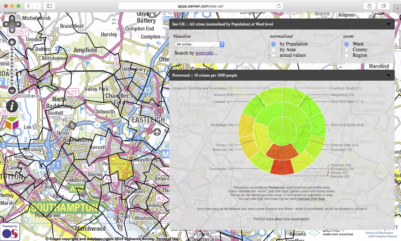
- crime
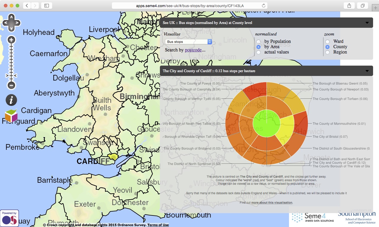
- transport
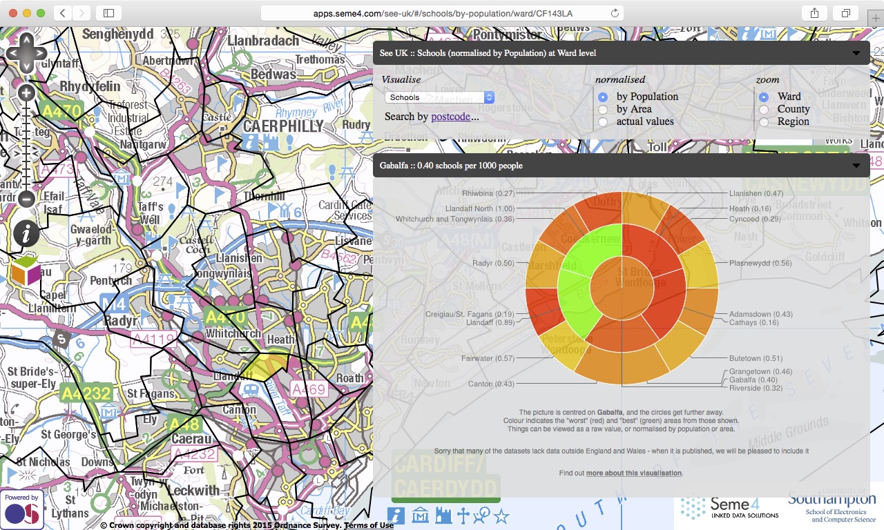
- education
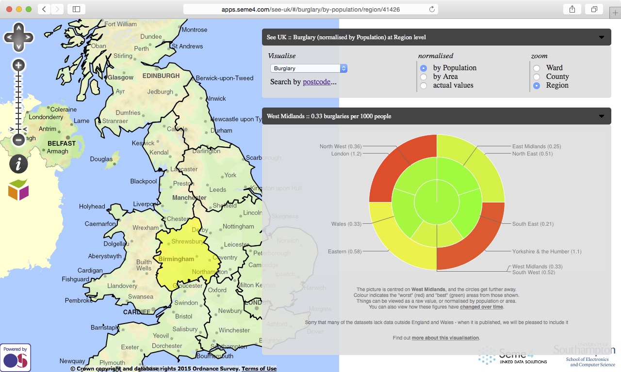
A unique feature of See UK is that it is able to use Linked Data technologies to normalise the data against other aspects of the regions, namely population and area.
The visualisation with coloured ring segments is an innovative was of looking at such data, where the neighbourhoods of the point of focus are shown in an abstract way, without the distraction of the map details, or even boundaries.
To build See UK, Seme4 harvested a wide variety of coordinate based public sector information Open Data sources and converted them into Linked Data.
Seme4 also had to use deploy complex aggregation tools, so that the data could be visualised at a number of magnifications.
In addition, complex geographic conversion services were used to convert between point and region specifications
See also See Soton